- 1 Introduction
- 2 Features
- 3 Specification
- 3.1 Drone
- 3.2 Mapping functions
- 3.3 GNSS
- 3.4 Visual positioning
- 3.5 Infrared System
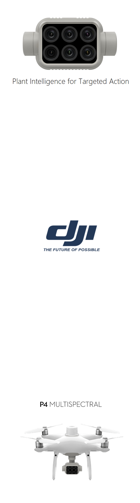
- 3.6 Camera
- 3.7 Gimbal
- 3.8 Battery
- 3.9 Intelligent charging station
- 3.10 Control panel
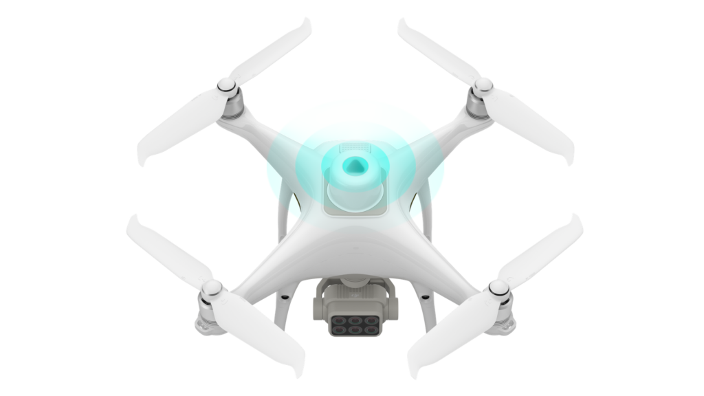
- 4 Appearance
- 5 Multispectral image processing system
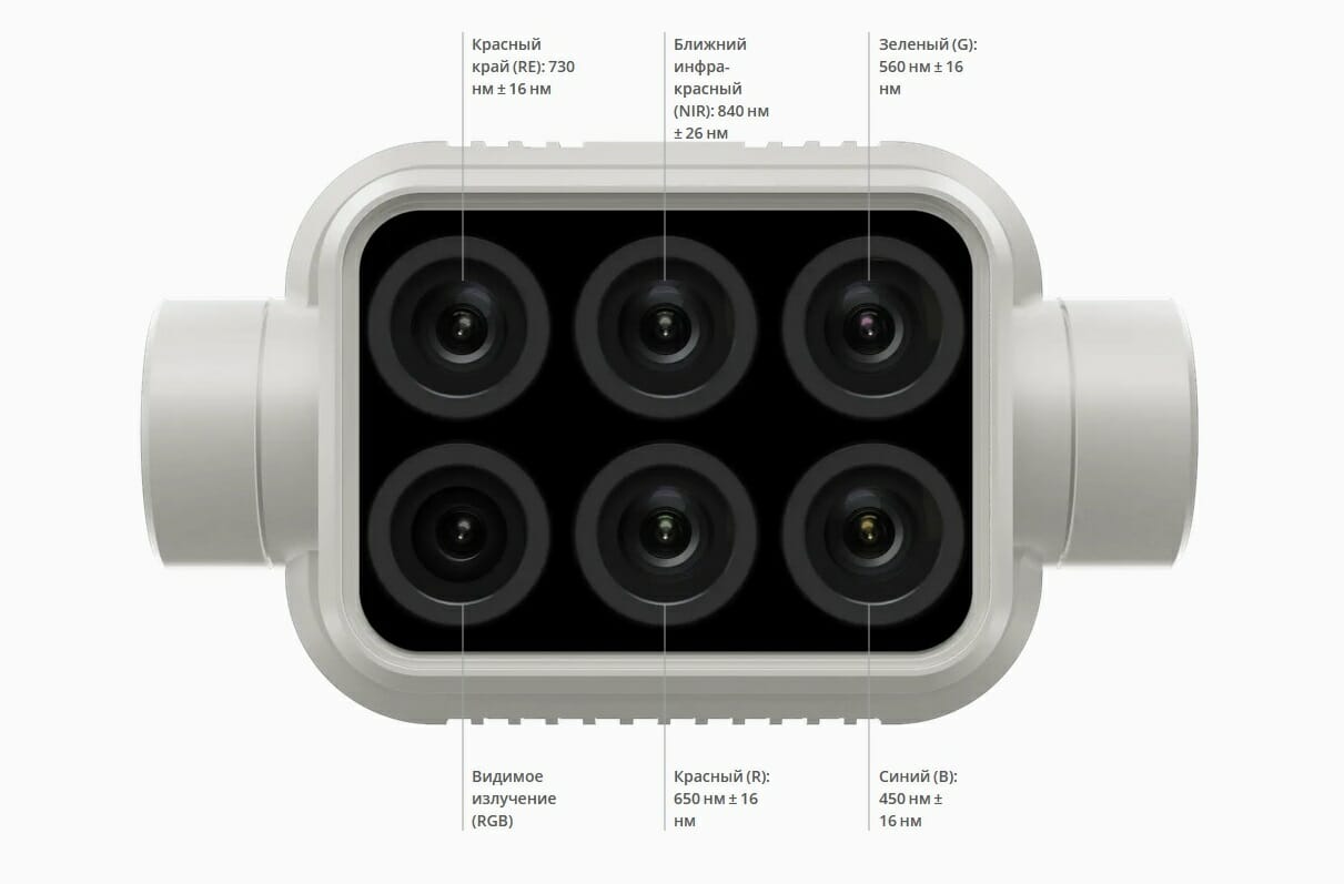
- 6 Spectral sun tracking sensor
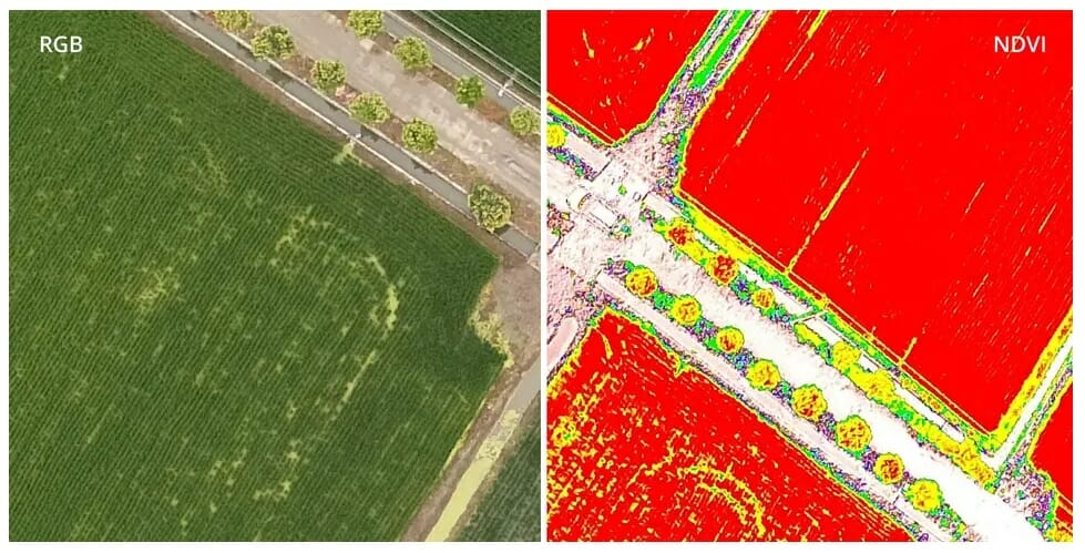
- 7 RGB and NDVI broadcast
- 8 Centimeter accuracy
- 9 D-RTK 2 and NTRIP compatible
- 10 OcuSync 2.0
- 11 Intelligent Agricultural Missions
- 11.1 Flight Plan
- 11.2 Data Capture
- 11.3 Data analysis
- 11.4 Actions based on findings
- 12 Application
- 12.1 Precision farming
- 12.2 Environmental monitoring and inspection
- 13 FAQ
- 13.1 Drone
- 13.2 Cameras
- 13.3 Control Equipment
- 13.4 Signal Transmission
- 13.5 Power supply
- 13.6 Software
- 13.7 Application
Introduction
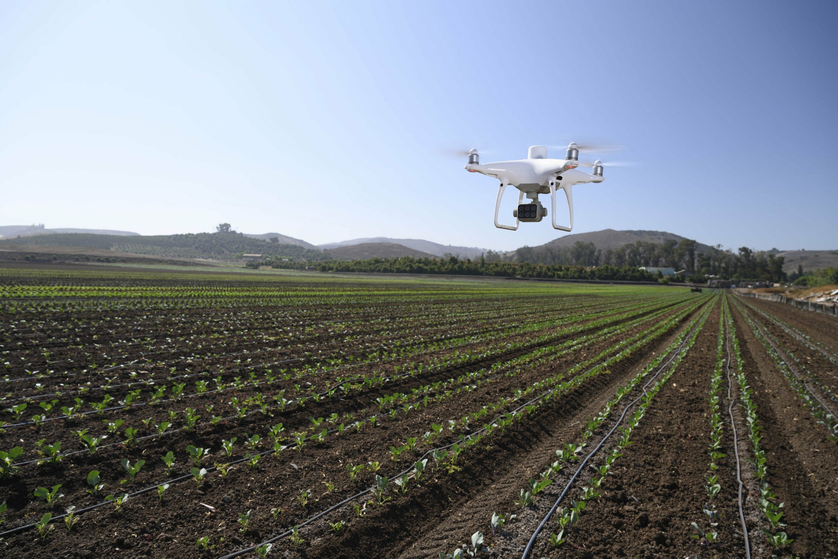
As part of the annual event DJI Airworks 2019Phantom 4 RTK platform, for the implementation of precision farming and land management. Phantom 4 Multispectral - is a high-precision drone model equipped with a multispectral image processing system that allows farmers and agronomists to quickly obtain the most accurate data on the state of the land and crops grown, which brings the industry to a new intelligent level of interaction with the environment.
In addition to the P4 Multispectral drone, the payloads " U10 UAV Based Laser Methane Leakage DetectorWingsland Z15
- The DJI Agras T16
- The DJI Disaster Relief Program is a new initiative, a disaster relief program aimed at quickly equipping emergency responders using DJ technology.
Features
- RTK module
- Centimeter positioning accuracy
- Multispectral Imaging System
- TimeSync Correction System
- Spectral Sun Tracking Sensor
- NDVI Real Time Broadcast
- 6-Way Obstacle Sensing System
- Automatic fly-by modes
- Flight planning application GS PRO
- OcuSync 2.0 video transmission system
- Fully compatible with D-RTK 2 mobile station
- Post-processing support PPK data
- Max. removal distance 10 km
- Max. flight time 27 minutes

Specification
Drone
18 km / h (Manual control)
GNSS
Spectral Sun Tracking Sensor
A built-in spectral sun sensor on top of the drone captures solar radiation for maximum accuracy and consistency of data collection at different times of the day. When combined with post-processed data, this information helps to obtain the most accurate NDVI results.
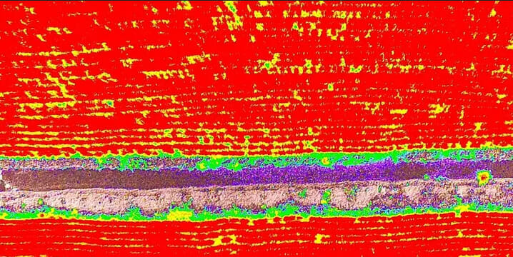
NDVI (Normalized Difference Vegetation Index) - a normalized relative vegetation index - a simple measure of the amount of photosynthetically active biomass (commonly called the vegetation index).
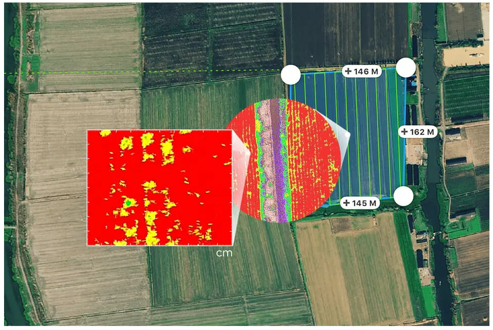
RGB and NDVI broadcast
The system allows the operator to switch between the preliminary normalized vegetation relative index (NDVI) and RGB model (visible radiation) to detect problem areas that need to be addressed in order to quickly make targeted decisions aimed at treatment.
Centimeter Accuracy
DJI's TimeSync Accuracy System allows the operator to obtain real-time location data for each image captured by all six cameras, thereby ensuring the accuracy of measurements at the centimeter level. The system constantly aligns the flight controller, RGB and NB cameras, and the RTK module, capturing the positioning data in the CMOS center, and ensures that every photo uses the most accurate metadata. All cameras go through a rigorous calibration process that measures radial and tangential lens distortion. The collected distortion parameters are saved in the metadata of each image, allowing the post-processing software to be customized individually for each user.
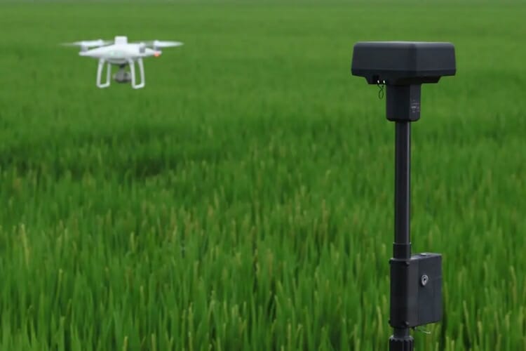
D-RTK 2 and NTRIP Compatible
high-precision mobile station GNSS D-RTK 2 and NTRIP (network transmission of RTCM corrections over the Internet protocol), or you can save the satellite observation data for later use in post-processing kinematics (PPK).
OcuSync 2.0
Top digital video transmission technology OcuSync, which allows switching between 2.4 GHz and 5.8 GHz frequencies based on the channel load, providing exponential noise immunity at the output and delay time at an FPV distance of up to 10 km (for P4 Multispectral).
Intelligent agricultural missions
Flight plan
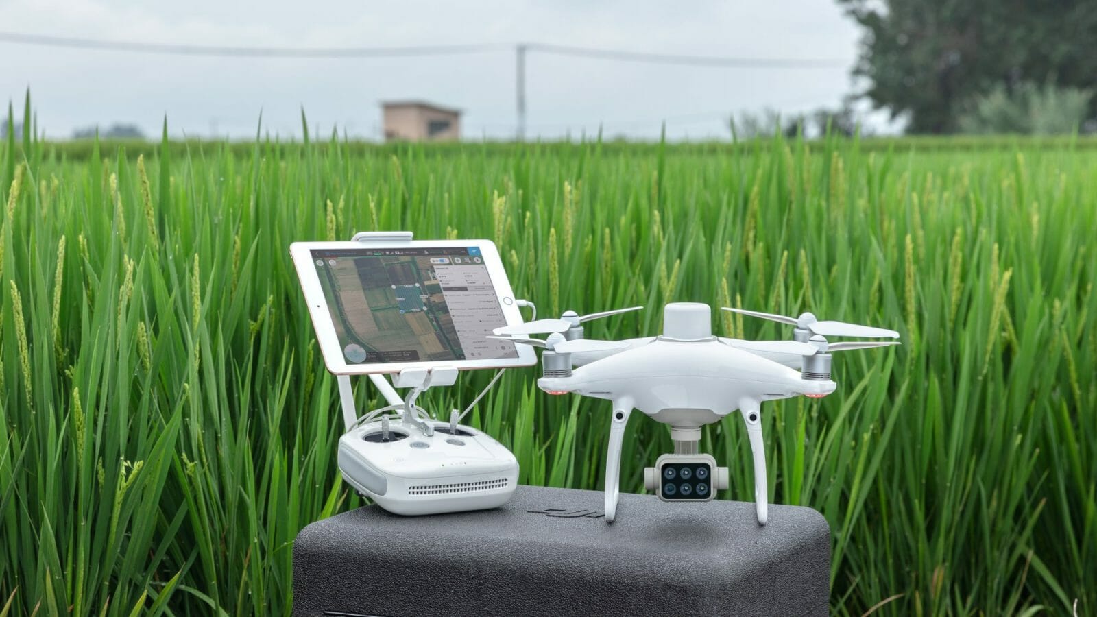
The operator can perform automated missions and flight control through the advanced DJI application - GS PRO, running on IOS devices.
![]()
Data Capture
P4 Multispectral allows the user to efficiently collect multispectral images over a large area and obtain an objective overview of problem areas.
Data Analysis
Easily access and manipulate aerial imagery using plant-specific metrics and parameters to achieve desired plant health outcomes.
Actions based on the received data
Based on the data received from the drone, the user can make the necessary decisions aimed at improving the condition with / x land and crops.
Applications
Precision farming
Multispectral imagery can be useful throughout the growing season, providing information through the electromagnetic spectrum invisible to the human eye. With access to this data and Vegetation Index data such as the NDRE and NDVI, farmers can make informed crop handling decisions in a timely manner, reducing costs, conserving resources and maximizing yields.
Environmental Monitoring and Inspection
Regular monitoring and inspection of plants can be made smarter and more efficient with the P4 Multispectral drone. The resulting multispectral data can be used to monitor forest health, measure biomass, map coastlines, or manage coastal vegetation while protecting habitats or ecosystems, and more.
FAQ
Drone
Q. How does P4 Multispectral differ from the Phantom 4 RTK?
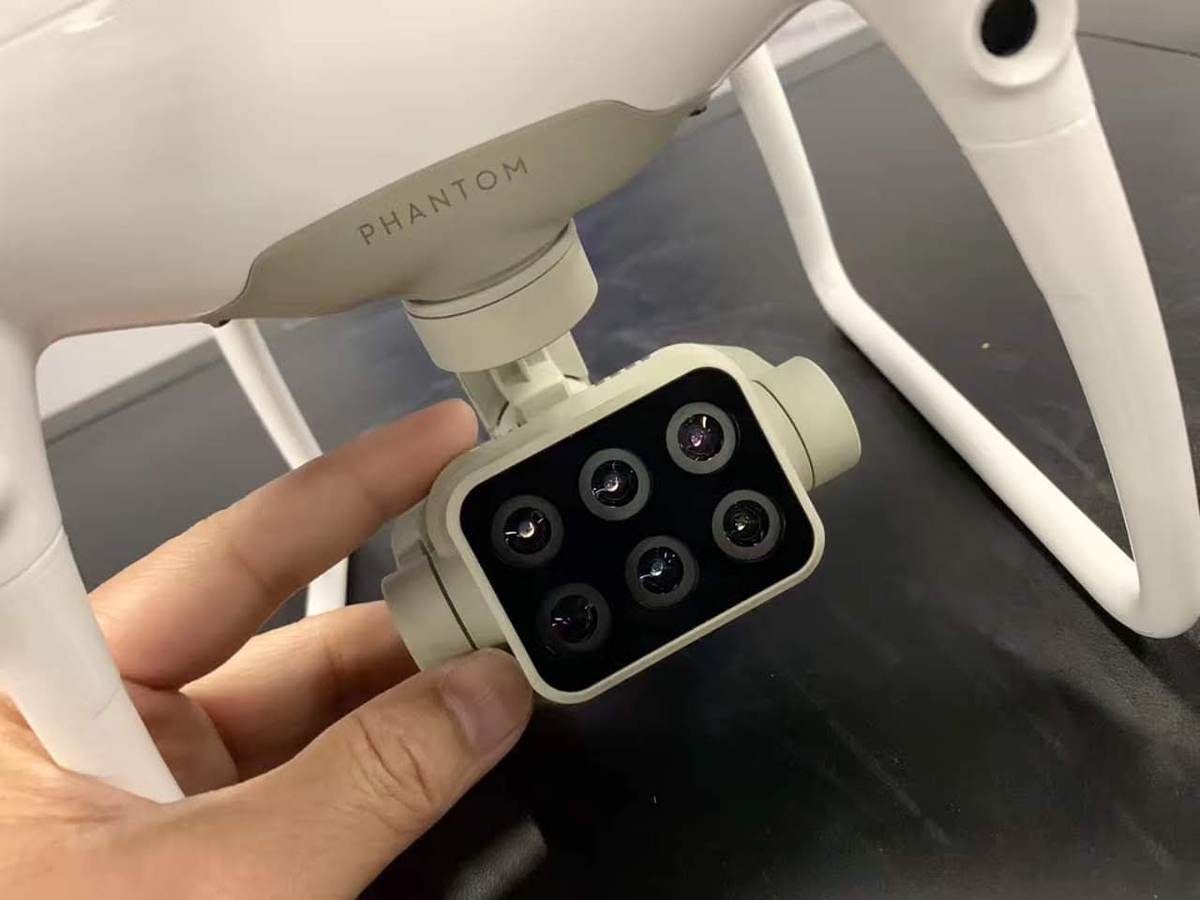
A. Both - RTK-compatible drone platforms. The main difference is the camera. The P4 Multispectral comes with a camera that consists of one RGB and five array-based multispectral cameras, each with a resolution of 2MP; while the Phantom 4 RTK comes with one 20MP RGB camera.
Q. What propellers does the P4 Multispectral use?
A. It uses the low noise 9455S propellers. Phantom 4 series drone props are also suitable, but they will degrade the flight characteristics of the P4M.
Q. What should be done to ensure the safety of the spectral sunlight sensor?
A. Keep it away from hard, sharp objects to avoid scratching.
Cameras
Q. What are the capabilities of the P4 Multispectral camera array?
The P4 Multispectral imaging system detects the emissivity of various objects, which is recorded by each of the cameras and analyzed to calculate the vegetation index values. A common index used in agriculture and forestry for plant health is the NDVI. Meanwhile, a spectral sunlight sensor located at the top of the drone compensates for sunlight received at different times of the day, improving the consistency of data from the same area of vegetation.
V. How is radiometric camera calibration implemented?
A. Your images are radiometric calibrated when you process them with the Vegetation Index features in DJI GS Pro and DJI Terra.
Q. Have the cameras on the P4 Multispectral been compensated for the image position?
A. Yes. The positions of the CMOS centers of the six cameras relative to the phase center of the onboard D-RTK antenna were calibrated and recorded in EXIF data for each image.
Q. Have the camera lenses gone through distortion correction?
A. Original images are not corrected for distortion, but each camera lens has been measured for distortion during production, and all correction parameters are recorded in each of the images.
Q. Have the cameras been corrected for vignetting?
A. Vignetting is not corrected on original images, but settings for correction are recorded in each image.
Q. How is consistency between multispectral camera arrays and spectral sun sensors on different drones ensured?
A. All P4M drones go through standard camera and sensor calibration to DJI industry standards, minimizing differences between drones.
Q. What is stored in image pixel values, DN values, or reflectance values?
O. DN Values.
Control equipment
Q. Which remote controller is compatible with the P4 Multispectral?
A. Currently, the P4 Multispectral is only compatible with the control hardware SDK that comes with the drone.
Signal Transmission
Q. What is the resolution of the P4 Multispectral video stream? O. 720p.
Power
Q. Can I use a P4 Multispectral battery on the Phantom 4 RTK?
A. Yes.
Q. How long does it take to charge the P4 Multispectral battery?
A. About 58 minutes.
PO
Q. Is there a limit on the number of waypoints for each departure?
A. The number of waypoints in each flight mission is not limited, but the drone can only perform actions up to 99 waypoints. When a flight mission has more than 99 waypoints, DJI GS Pro automatically divides waypoints into groups, each with a maximum of 99 waypoints.
Q. What are the flight altitude and speed limits?
O. Max. flight altitude: 500m, minimum: 1m. Max. flight speed: 54 km / h, minimum: 3.6 km / h.
Q. Which flight mode should I use if I want to switch between RGB live and NDVI?
A. You can switch between RGB live and NDVI in manual mode. We recommend that you stay in RGB mode and do not switch between channels during flight. JPEG images will be automatically saved in RGB or NDVI depending on the camera mode. Most third-party mapping software requires RGB images for aerial triangulation before overlaying NDVI maps.
Q. What are the recommended camera settings?
A. For novice users, the developer recommends setting the multispectral mode to Auto, selecting “Average Metering” as the metering mode, and choosing AE unlock.
Q. Does P4M software support fan developers?
A. Support for the DJI Mobile SDK will be available soon.
Q. What vegetation metrics are supported in DJI Terra?
A. DJI Terra supports NDVI, GNDVI, NDRE, LCI, and OSAVI, but does not have a Vegetation Index calculator feature.
Application
Q. Can I reconstruct maps using third party software? O.Yes.
Q. How do I calculate an appropriate flight altitude based on a ground pixel size (GSD) value?
O. The GSD for the P4 Multispectral is (H / 18.9) cm / pixel. You can calculate the flight altitude with the accuracy you need.
Q. What is the maximum mapping area for one flight?
A. In one flight, at an altitude of 180 m, P4 Multispectral has a maximum display area of about 0.47 km², i.e. The GSD is approximately 9.52 cm / pixel.
Q. Are any altitude information reflected in the mission waypoints?
A. Altitude information (relative to your take-off point) is stored in photographs taken at waypoints.
Q. Is the P4 Multispectral compatible with third party base stations?
A. No, you cannot connect third party base stations to the P4 Multispectral or to the remote control via a radio. However, you can receive data from a network RTK server using NTRIP protocol in a 4G / Wi-Fi network environment. Satellite observation data can also be saved by the user in the drone for subsequent post-processing using the kinematic method (PPK).
.


