Introduction
Currently, drones are widely used, because are designed to solve problems such as monitoring the ecological state of forests, agricultural land (taking samples of air, water, soil and other remote studies of the land).
Algorithm of work
UAV operation in the local monitoring mode is as follows. According to the signal of the ground navigation inertial integrated system, a map of the survey area and the coordinates of the vehicle or operator are displayed on the monitor of the laptop.
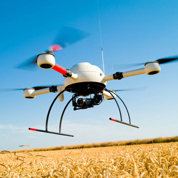
Using the keyboard, the flight path (snake, straight line, etc.), flight speed, altitude and end point of the route are programmed. The drone's flight takes place completely autonomously. After reaching the desired altitude, the quadcopter begins to move along the trajectory, transmitting the coordinates of its movement and the video image in real time.
A map of the surveyed area, the coordinates of the video image, the video image of the surface area and the final point of the route are displayed on the laptop. During the flight, the quadcopter can hover over the specified point, change the flight speed and hover height.
Landing is automatic. With additional equipment of the drone with batteries or the introduction of a second drone, it becomes possible to carry out long or continuous patrols of the area.
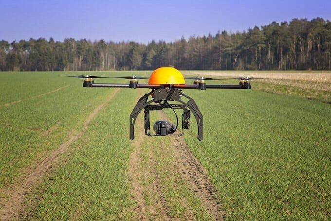
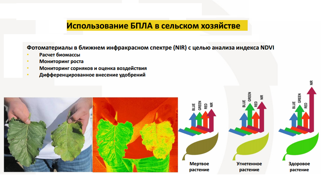
Devices for a wide-profile study of the environment, or rather for collecting various information (chemical, biological or radar), can also serve as additional equipment.
The module with sensors has autonomous seats and, depending on the assigned tasks, can be replaced during work. In addition, the telemetry data includes wind speed, pressure and temperature.
Unmanned technologies are an effective means of ensuring the research and functioning of land infrastructure objects. Using such technologies, the following tasks are solved:
- Information support for insurance and property accounting, land management and cadastral works,
- Monitoring of fields and agricultural land with increased environmental load,
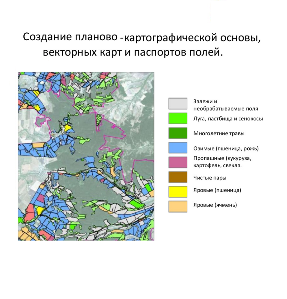
- Creation of various cartographic materials for studying the operation of land facilities.
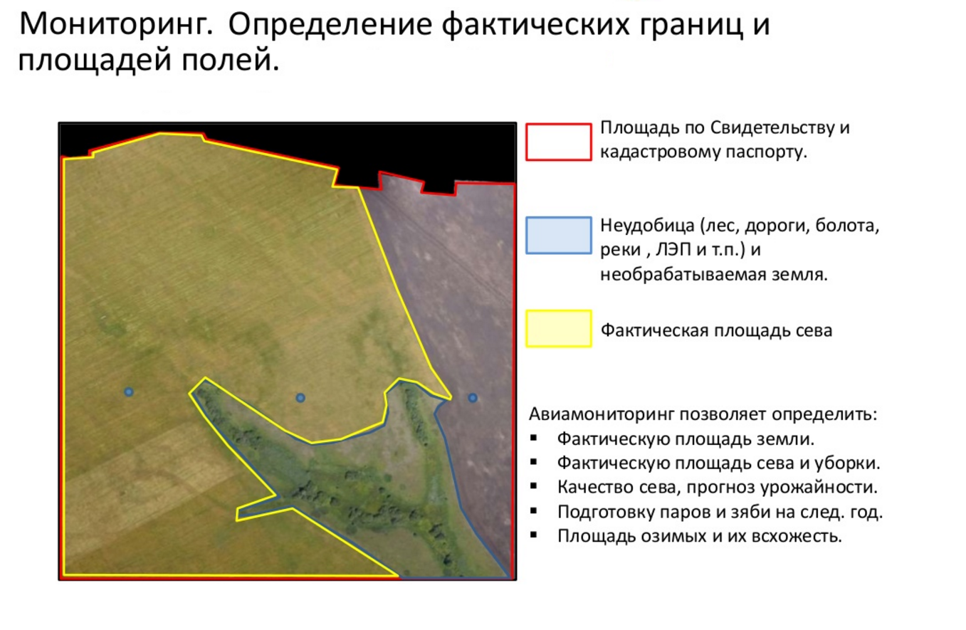
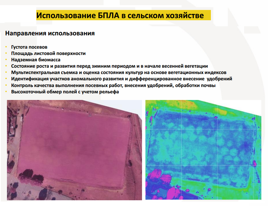
boundaries of sites, high-precision positioning of land surveying lines, etc. Metric photomaps and photomaps are made on the basis of primary materials of unmanned survey, by the method of matching and gluing separate adjacent or intersecting images of agricultural land and fields using conventional points and planning-high-altitude justification of photography without taking into account the landscape relief. Such schemes are created for relatively small areas and are subsequently used for their vectorization in order to obtain digital plans of fields and agricultural areas.
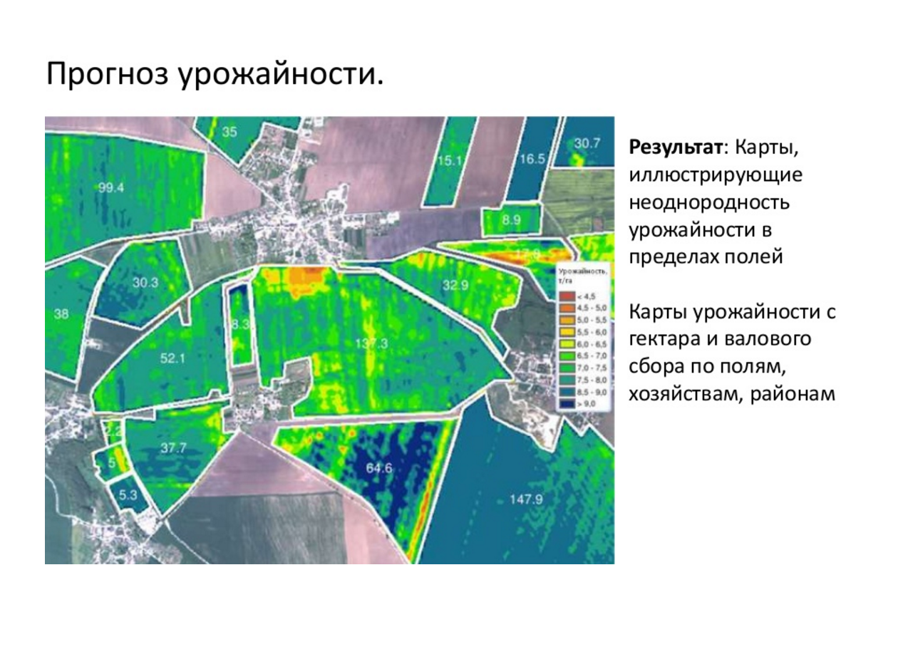
Applying the products of mapping land plots based on the materials of aerial survey of UAVs, such important tasks are solved as:
- Assessment of the current state of agricultural territory, current comparative analysis of changes in the components of the landscape of the territory (plowing, vegetation, etc.)
- Delimitation of individual areas based on photographic data
- anthropogenic processes and natural phenomena.
You can familiarize yourself with the catalog of professional UAVs here
.


