- 1 Introduction
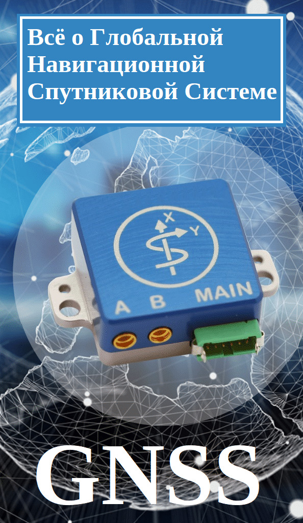
- 2 What is GNSS or Global Navigation Satellite System?
- 3 How does the global navigation satellite system or GNSS work?
- 4 Applications of global navigation satellite services
- 4.1 GNSS for navigation
- 4.2 What is WAAS?
- 4.3 What is GBAS or LAAS?
- 4.4 GNSS for surveying and geological mapping
- 4.5 GNSS applications in other industries
- 5 Sensors of inertial measuring devices or INS systems
- 5.1 Let's go a little deeper
- 6 Summarize
Introduction
Before we look at the history of the Global Navigation Satellite System (GNSS, GNSS; hereinafter referred to as GNSS) or real-time kinematics (RTK or Real Time Kinematic)
This is a basic overview of the satellite navigation system as we know it, but today we take it one step further to discuss an advanced satellite navigation system known as GNSS. Any satellite navigation system with global coverage capability is called global navigation satellite system or GNSS. But that is not all. GNSS has a secret weapon...
One technology that GNSS often relies on is real-time kinematics, or RTK. Real-time kinematics is a global satellite positioning technique that helps GNSS improve the reliability and accuracy of target data. When it comes to positioning, positioning and maximum accuracy, the combination of GNSS with RTK increases a level of accuracy unlike anything else. RTK amplifies the phase signal exchanged between the transmitter and receiver, thereby providing centimeter level accuracy and real-time signal correction.
What is GNSS or Global Navigation Satellite System?
Global Navigation Satellite Systems were originally developed by the US Air Force, when the technology was called the Global Positioning System, or GPS, and could only be used by the US military. Over time, GPS technology has become available to everyone on this planet. Now that every smartphone equipped with GPS is easily accessible to everyone, the governments of several countries have decided to take this technology to a more advanced, accurate and long-term level. Thus, the emergence of Global Navigation Satellite Systems or GNSS has become an official phenomenon for private sector consumers.
Currently, in addition to the United States, GLONASS of Russia and Galileo of the European Union are the two main operational GNSSs operating on the surface of our planet. With the advent of GNSS technology, many assistive technologies, known as Regional Navigation Systems, began to operate. The technology concept is the same as that of GNSS, but covers fewer geographic areas.
![]()
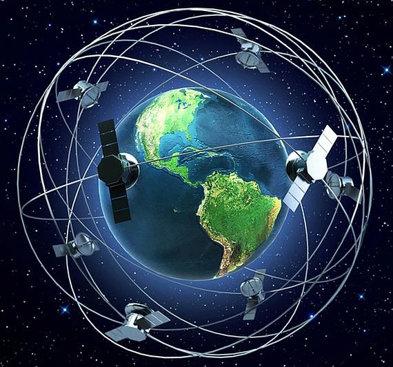
How does the global navigation satellite system or GNSS work?
GNSS satellites have two carrier waves recorded in the L band, namely L1 (1575.42 MHz) and L2 (1227.60 MHz). The main purpose of these two wavelengths is to transmit signals from a connected satellite to the earth's surface. According to Techopedia, the use of L-band technology can reduce overhead while providing a reliable connection that is less prone to interruptions. The introduction of L-bands with the correct antenna placement offers a number of advantages for agricultural drones
On the other hand, GNSS receivers located on the surface of the earth consist of an antenna and a processing unit. The purpose of the antenna is to receive encoded signals from connected satellites, and the task of the processing unit is to decode the signals into meaningful information.
Note: To locate one receiver, GNSS must collect data from at least three separate satellites.
Each GNSS satellite orbits the Earth at an interval of 11 hours 58 minutes and 2 seconds. The time information transmitted by the satellite is transmitted using codes so that the receiver can determine the time interval during which the code was transmitted.
Signals transmitted from a satellite contain encoded data that help receivers to pinpoint its location, and the receiver itself positions itself exactly according to the position of the satellite.
The IC receiver calculates the time difference between the broadcast time and the reception time of the encoded signal. Once the receiver is positioned exactly relative to the satellite, the processing unit translates the receiver's location in terms of latitude, longitude, and altitude. So, based on this simple concept, every GNSS operates on the surface of this planet.
Applications of global navigation satellite services
The advent of GNSS technology has changed the concept of position tracking with a high degree of accuracy and wide range of coverage. There are several major GNSS applications that have helped the world see a better future.
GNSS for navigation
Among all other technologies, the concept of GNSS has had a major impact on navigation technology. Recently, GNSS has been incorporated into the automotive industry, now almost every automotive company is integrating GNSS technology into their car models. The integration of GNSS technology helps the driver easily navigate unknown routes to explore the roads of the world.
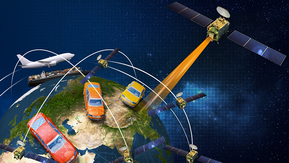
The use of GNSS in navigation systems is not limited to automobiles, as the technology is now widely used in aircraft as well. Preliminary terrain mapping and real-time terrain updates from GNSS allow pilots to avoid collisions in air traffic. Moreover, the GNSS used in aircraft cockpits also uses technologies such as WAAS or GBAS (LAAS) to improve heading accuracy.
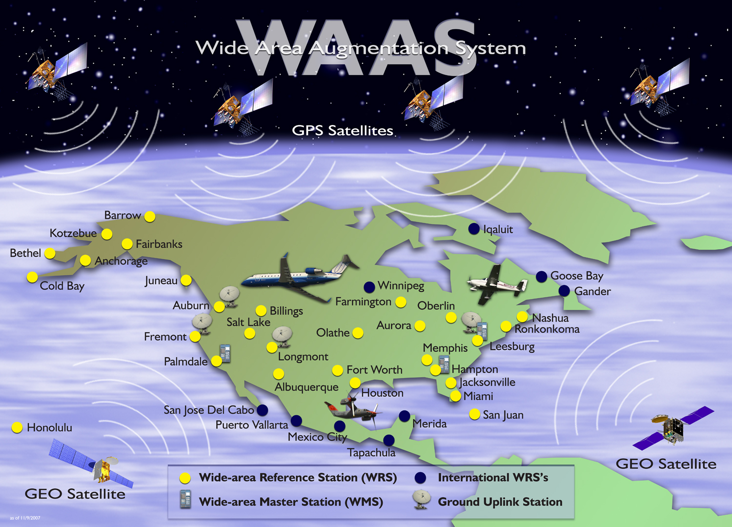
What is WAAS?
Unlike traditional ground-based navigation aids, the Wide Area Augmentation System (WAAS) provides navigation services throughout the National Airspace System, according to the Federal Aviation Administration. System or NAS for short). WAAS provides additional information to GPS / WAAS receivers to improve the accuracy and integrity of current position estimates.
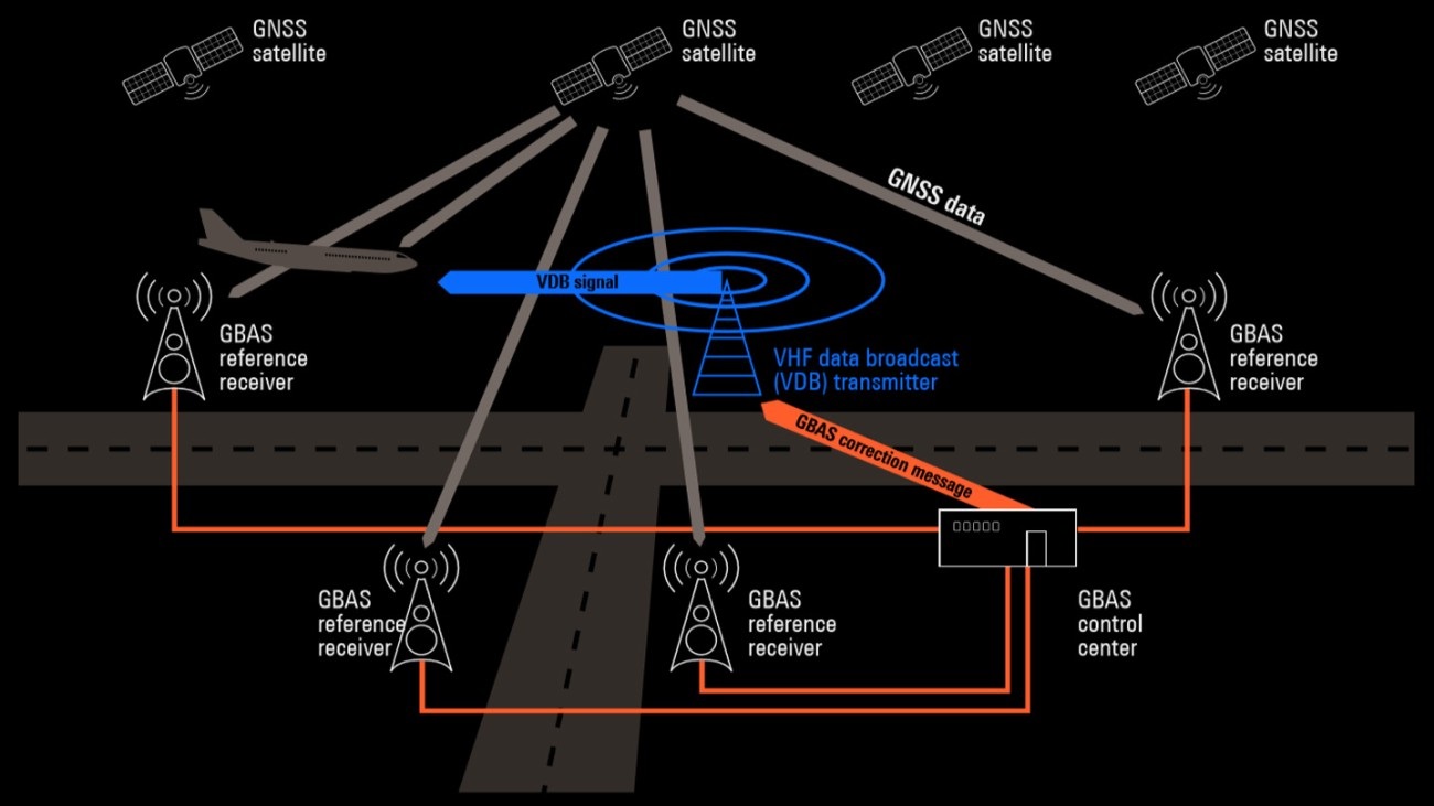
What is GBAS or LAAS?
Historically, the Federal Aviation Administration (FAA) once referred to what we now call GBAS, LAAS. According to the Federal Aviation Administration website, the Ground-Based Augmentation System (GBAS) is a system that provides differential corrections and monitoring of the integrity of global navigation satellite systems (GNSS).
In addition to the wide range of applications of GNSS in automobiles and aircraft, GNSS is also used to navigate boats / yachts and ships on the surface of the water.
Note: ships also use a GNSS functional block called "Man Overboard" or abbr. MOB. This feature allows the ship's crew to pinpoint the location of a person who has fallen overboard.
GNSS for surveying and geological mapping
Geodetic surveying and geological mapping is another important application of GNSS. Most GNSS receivers use signal data generated at the L1 wave frequency to perform geological mapping. It is equipped with a precision crystal oscillator that helps the wave to reduce clock errors when mapping. Researchers can also make highly accurate measurements by calculating the appropriate offset between GNSS sensors.
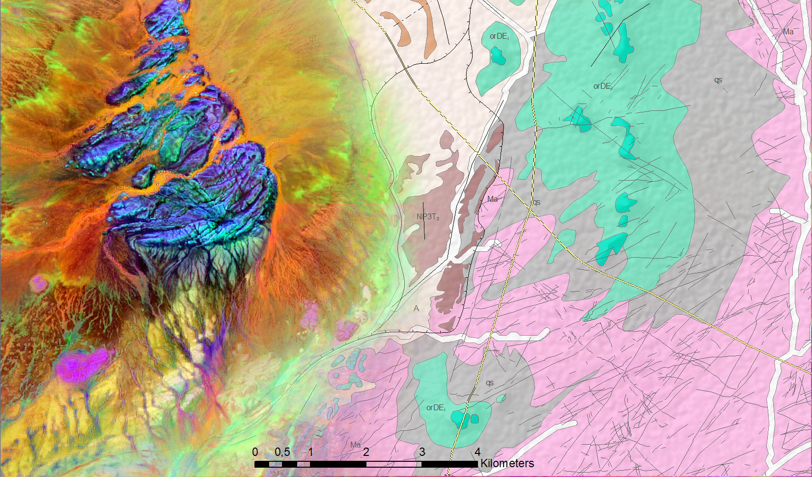
For example, if an actively deforming area (say a volcano) is surrounded by several receiving stations, then GNSS can be useful for detecting any kind of deformation or ground movement.
GNSS Applications in Other Industries
In addition to the above GNSS applications, important ones also include:
- Mobile Satellite
- Location-based Emergency and Precision Services
- Improving Weather Forecast
- Photographic Geocoding
- Marketing and More

Inertial Measurement Device or INS Sensors
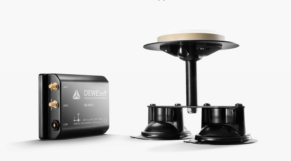
Inertial Measurement Unit (IMU) plays a vital role in global navigation satellite systems. As discussed above, the GNSS system collects data signals from at least three of the satellites in orbit, where every signal received by the receivers is incredibly accurate.
However, if the signal is obstructed by any obstacles such as trees, boulders or buildings, the signal can no longer provide accurate positioning. An inertial measurement unit is a kind of inertial sensor that calculates the rotation and acceleration of a moving body to determine its position in space.
Let's go a little deeper into the details
The IMU consists of 6 additional sensors located along three other orthogonal axes, where each of them also consists of an accelerometer and a gyroscope. The task of the accelerometer is to measure the linear acceleration of a moving body, while the gyroscope measures the acceleration of rotation. Thus, by calculating the values of these two sensors, the system can easily determine the exact location of the moving body. In tandem, GNSS and IMU provide end users with more powerful and accurate navigation solutions.
To summarize
Thanks to recent technological advances, many concepts and technologies have significantly changed the playing field for robotics, satellite communications and navigation as we know them. The Global Navigation Satellite System is a key player among the innovative technologies that have improved everyday life as we know it today. What's more, RTK provides GNSS with centimeter-level accuracy with real-time signal corrections. Combining GNSS and RTK provides the highest accuracy and the highest tracking quality you need. After all, GNSS and RTK are the most powerful combination on the market today.
In this overview, we have explored all the possible areas for GNSS and discussed in detail its concepts, operating principles and applications. We hope that the presented material has fully informed you about GNSS technology, enlightened and inspired you to achieve your goals. Thank you for your attention.
.


