- 1 Introduction
- 2 Features
- 3 Package contents
- 4 Specification
- 4.1 Drone
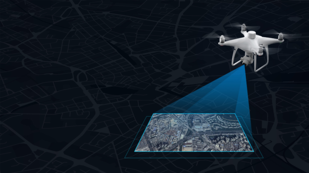
- 4.2 Mapping functions
- 4.3 Visual positioning
- 4.4 Camera
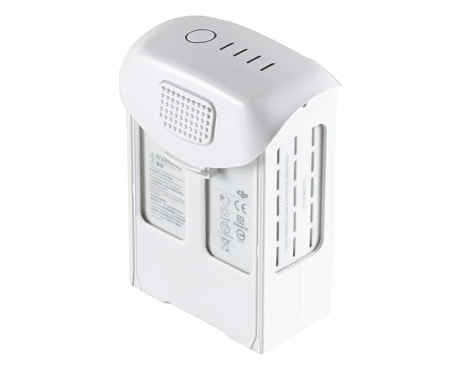
- 4.5 Battery
- 4.6 Smart Charging Station
- 4.7 GNSS
- 4.8 Suspension
- 4.9 Infrared system
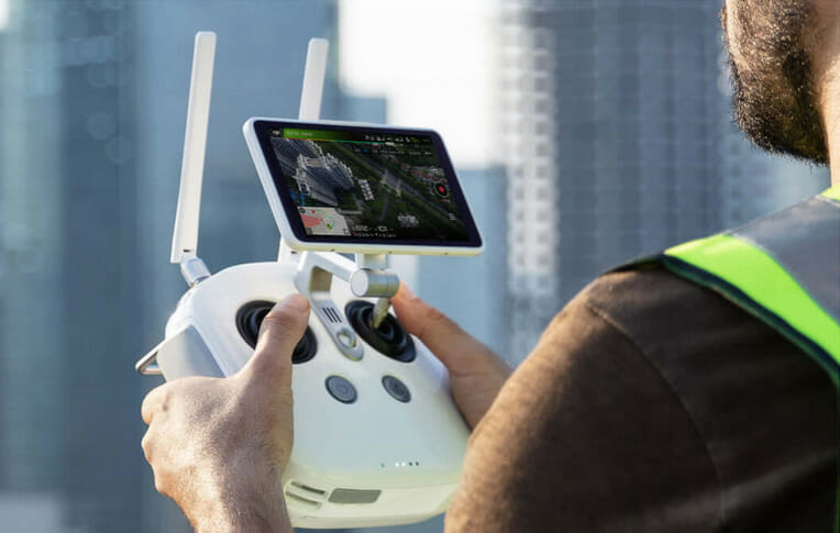
- 4.10 Control panel
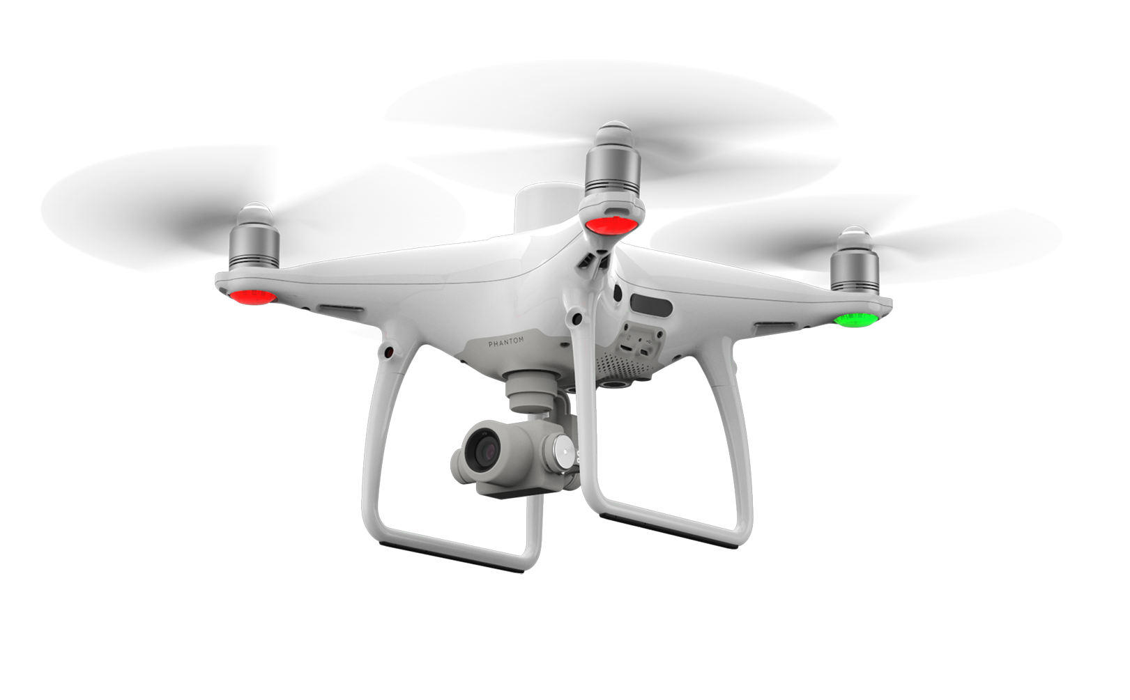
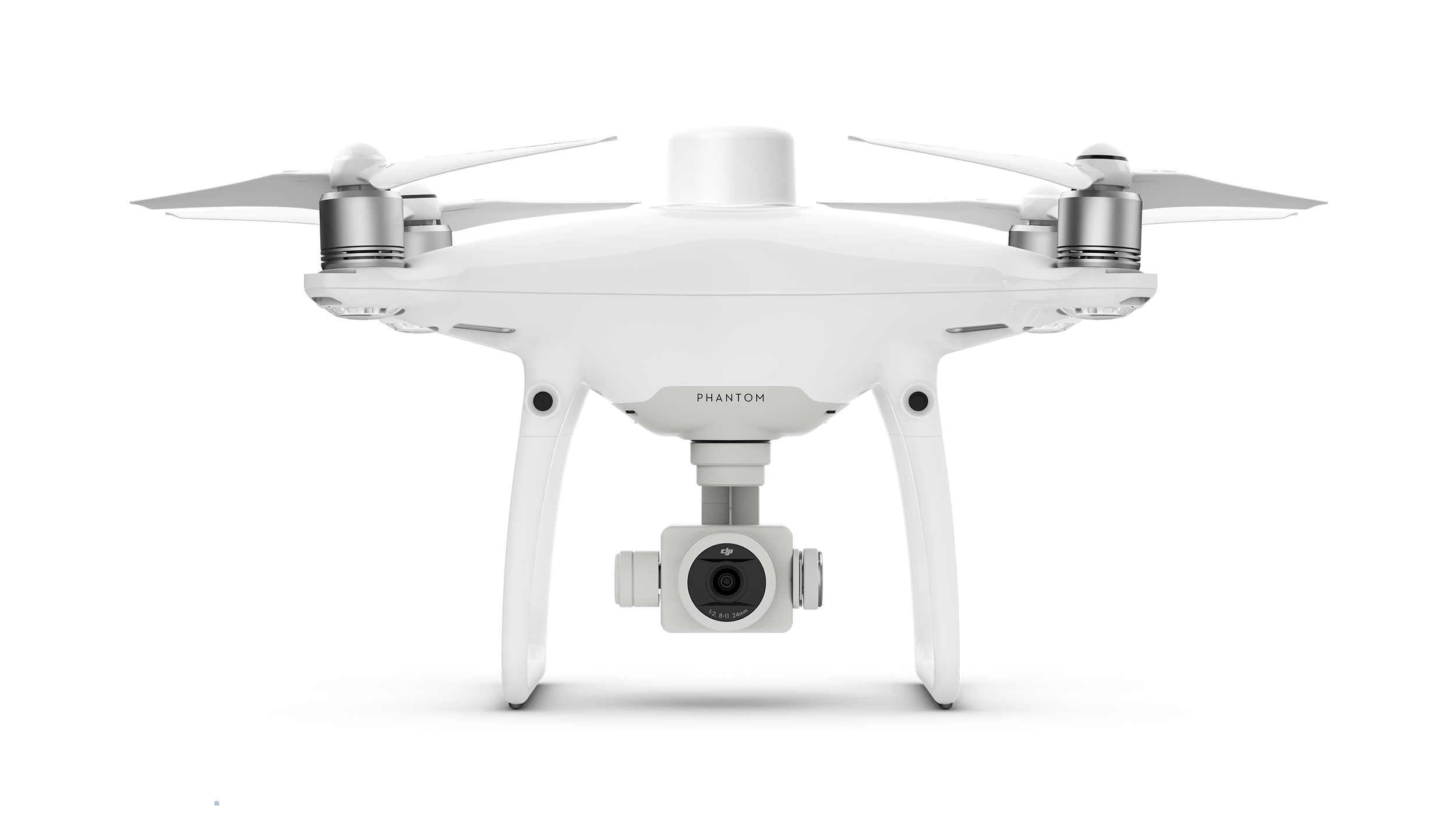
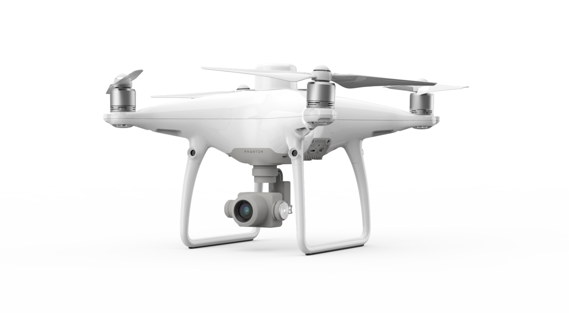
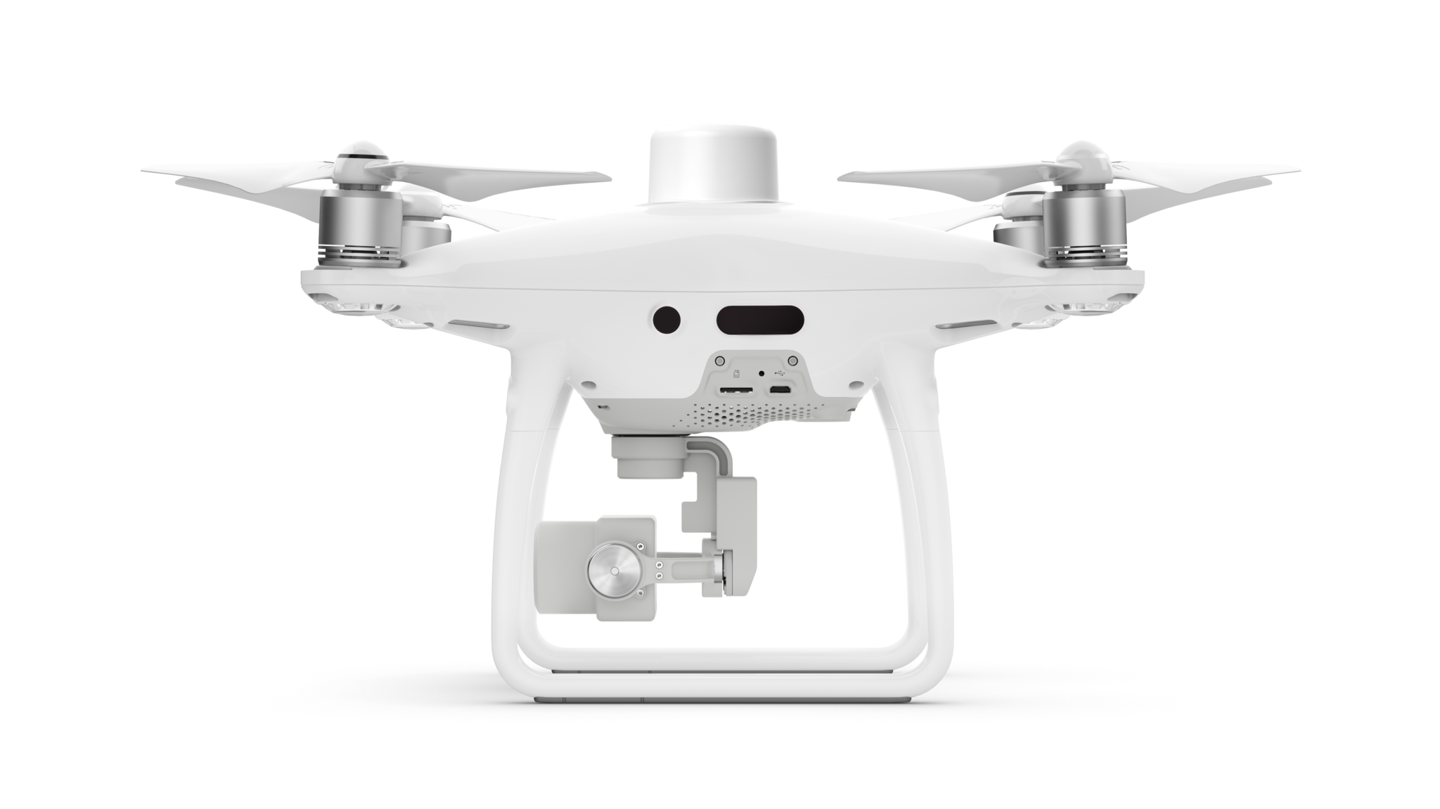
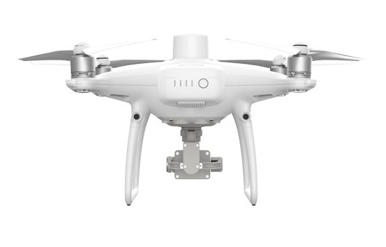
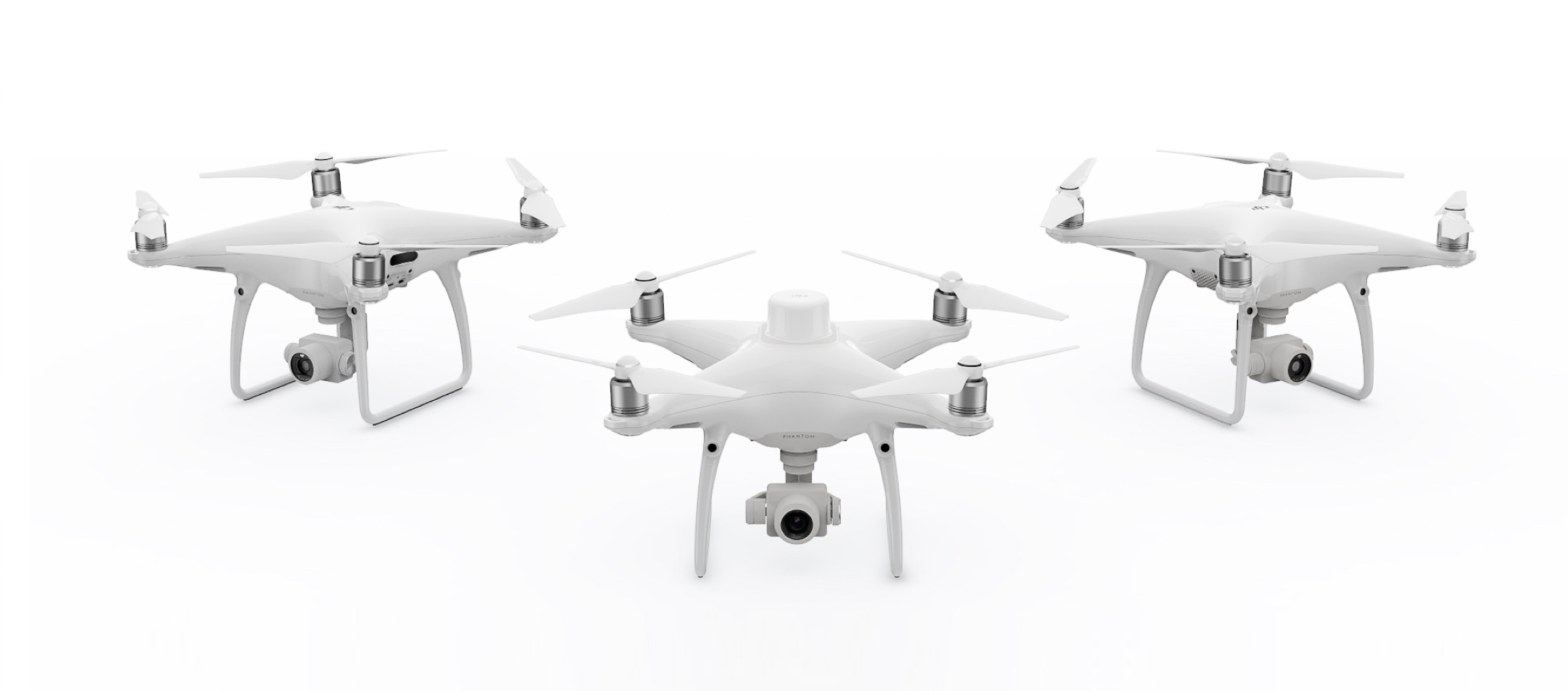
- 5 Appearance
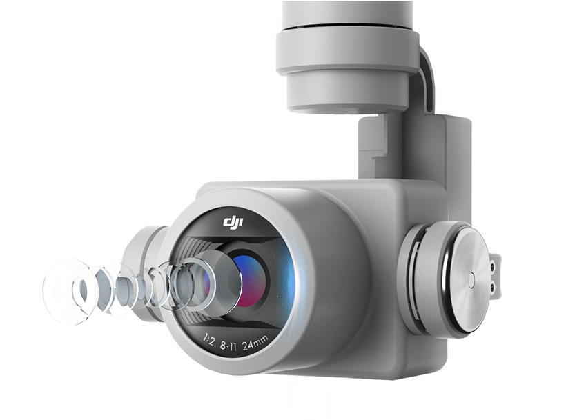
- 6 Camera
- 7 Positioning System
- 8 TimeSync
- 9 OcuSync 2.0
- 10 GS RTK Application
- 11 D-RTK Mobile Station 2
- 12 Mobile SDK support
- 13 Phantom 4 RTK in practice
- 14 Price
- 15 FAQ
- 15.1 Drone
- 15.2 Camera
- 15.3 Remote Control
- 15.4 Video stream
- 15.5 Battery
- 15.6 Positioning
- 15.7 Software
- 15.8 Mapping
- 16 Videos
Introduction
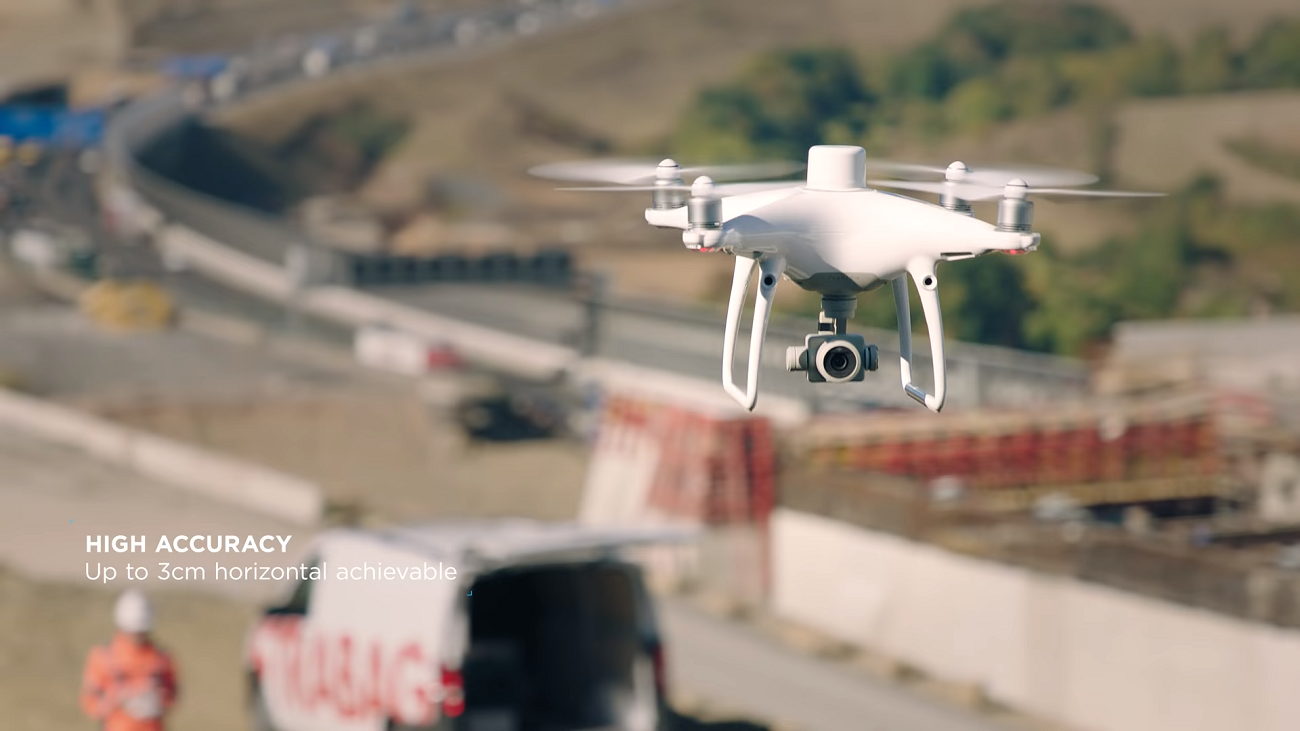
On October 15, the world leader in civil unmanned aerial vehicles and aerial photography technologies - DJI Innovationsthe commercial versionPhantom. The Phantom 4 RTK is a high-precision, powerful imaging system designed to meet the specific needs of industrial users in areas such as mapping and inspection.
Features
- New RTK module
- Centimeter positioning accuracy with fewest control points
- Positioning accuracy in horizontal plane: 1cm 1md
- Positioning accuracy in the vertical plane: 1.5cm 1md
- Absolute accuracy of the photogrammetric model in the horizontal plane: 5cm*
- New TimeSync correction system
- New flight planning application GS RTK
- 2 gliding modes
- Precise image processing system built on 1-inch 20MP CMOS sensor with mechanical shutter
- Mobile SDK support
- OcuSync 2.0 transmission system
- Fully compatible with the mobile station D-RTK 2
- Adapted for work in metropolitan areas
*When flying in sunny weather at an altitude of 100m, the pixel size on the ground (GSD) 2.74 cm.
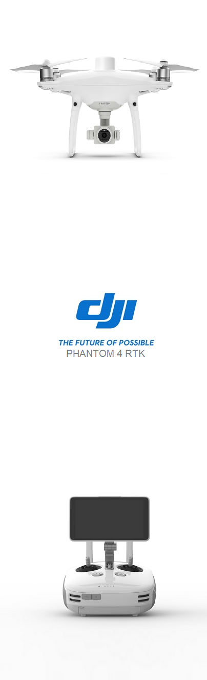
Package contents
Package contents of the Phantom 4 RTK entirely depend on the tasks set by the customer (user). To order a drone, it is recommended that you contact your nearest official DJI dealer, or send your contact information to the DJI team via the official website so they can contact you.
Basic kit will include:
- Phantom 4 RTK
- Controller with built-in 5.5-inch super bright display,
- 2 × smart batteries for P4 RTK,
- 1 × smart battery for the control panel,
- charger for simultaneous charging of both batteries,
- Charger power adapter connecting cable,
- 8 × Rotating Screws (4CW / 4CCW)
- Camera Gimbal
- 16GB MicroSD
- Shipping Case
- Micro-USB Cable
- USB-C cable
- USB-C OTG cable.

Specification
Drone
Mapping Functions
Visual positioning
Camera
Battery
Intelligent charging station
GNSS
Appearance
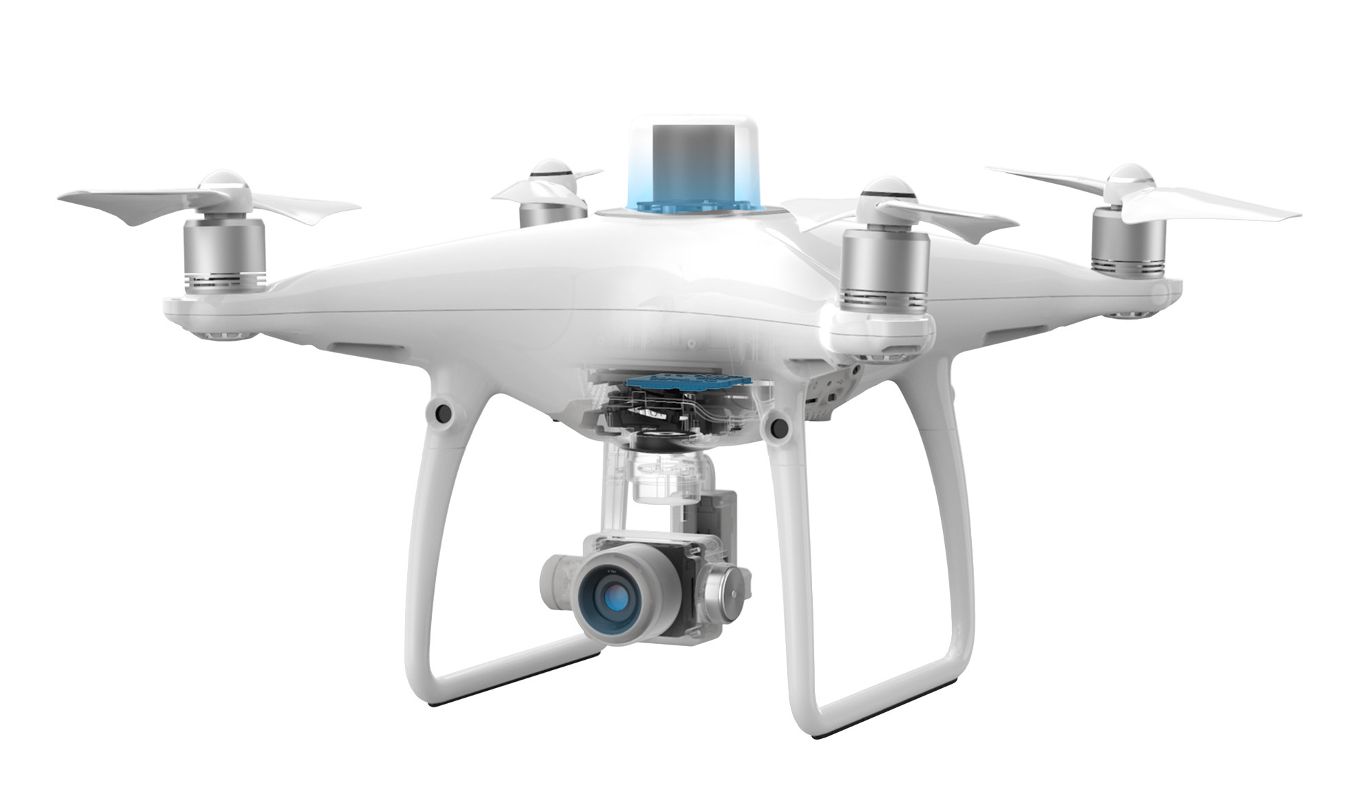
Camera
At its core, a 1-inch 20-megapixel CMOS sensor works in tandem with a mechanical shutter that eliminates image distortion when shooting in motion, thereby allowing for mapping missions or regular data collection seamlessly. Thanks to its high resolution, the Phantom 4 RTK can reach a GSD of 2.74cm from a height of 100 meters. To ensure this unprecedented accuracy, each lens goes through a rigorous calibration process that measures radial and tangential lens distortion. The collected distortion parameters are saved in the metadata of each image, allowing the post-processing software to be individually adjusted for any user.
In areas without RTK coverage, the Phantom 4 RTK will enable Post Processing Kinematic (PPK). The drone captures the original satellite observation data as well as ephemeris data and saves them in the PPKRAW.bin file in RTCM 3.2 format. In addition, the P4 RTK converts satellite data on the fly to RINEX (Receiver Independent Exchange Format) and writes it to the RINEX.obs file.
By internally synchronizing the position of the GNSS and the camera, the Timestamp. MRK file provides an accurate record of the highly accurate position of the image. All data related to operations is stored on the microSD card in a unique folder for each individual mission. Phantom 4 RTK data consistency reduces verification time and enables efficient post-processing workflow with minimal manual adjustments.
Positioning system
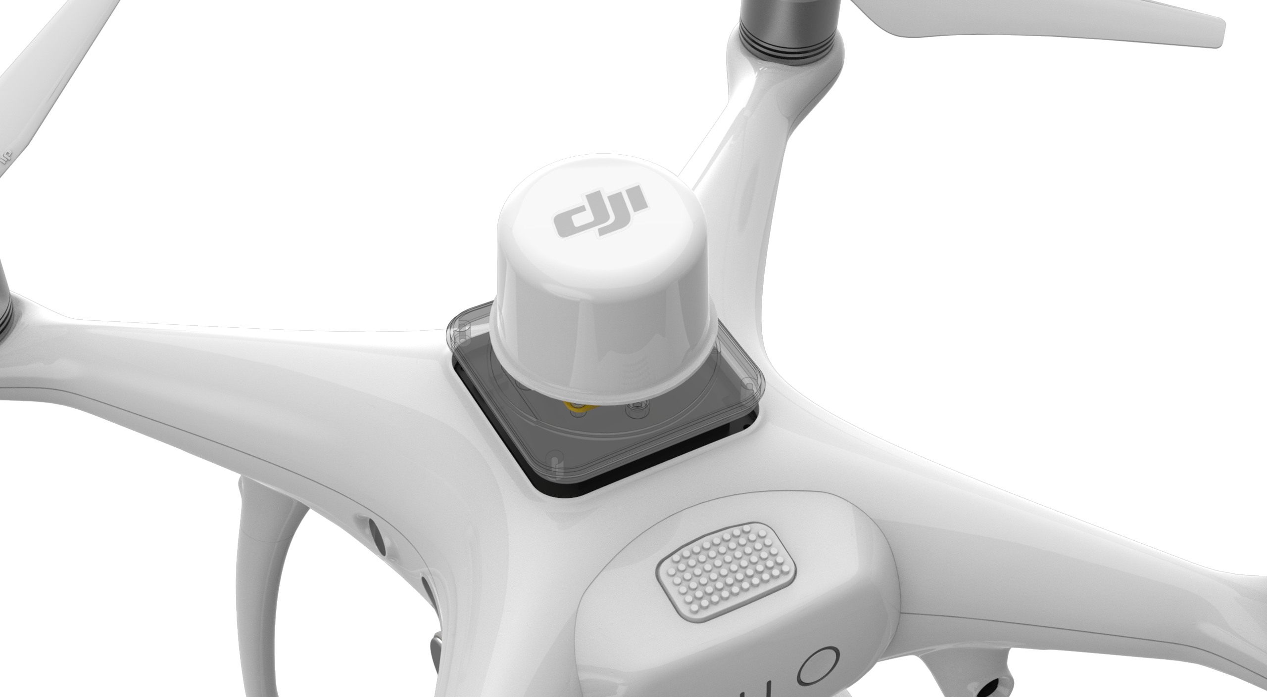
real-time centimeter positioning accuracy of the received data.
Without an RTK module, an unmanned aerial vehicle requires up to 40 ground control points (GCPs) per square kilometer, which is time-consuming in practice. The DJI Phantom 4 RTK has a built-in centimeter-precision RTK positioning navigation system that works in conjunction with a high-performance imaging system. Tandem potentially reduces the number of breakpoints required for "0", saving at least 75% of setup time.
Directly below the RTK receiver is a backup GNSS module for stable flight in low signal areas such as large cities. The Phantom 4 RTK modular tandem optimized flight safety and the most accurate data for complex surveying, mapping and inspection workflows.
The RTK module can achieve 1cm 1ppm (horizontal), 1.5cm 1ppm (vertical) positioning accuracy, and the Phantom 4 RTK can achieve 5cm absolute photogrammetric model accuracy in the horizontal plane * (* When flying in sunny weather at an altitude of 100m, ground pixel size (GSD) 2.74cm).
TimeSync
![]()
New system for collecting accurate data - TimeSync. Provides continuous alignment of the flight controller, camera and RTK module. In addition, TimeSync ensures that every photo uses the most accurate metadata and captures it at the center of the CMOS, which in turn optimizes the results using photogrammetric techniques, allowing the image to match positioning data at the centimeter level.
OcuSync 2.0
The OcuSync 2.0 video transmission system provides a stable, anti-jamming connection between the control equipment and the drone at a distance of up to 10 km with video link quality 720p, ideal for large area mapping. The flight time interval of up to 30 minutes will allow pilots to complete longer missions without the need to land to change the battery.
Even if one battery is not enough to cover the entire working area, after changing the power, “Operation Resumption” will automatically resume the GS RTK application.
GS RTK app
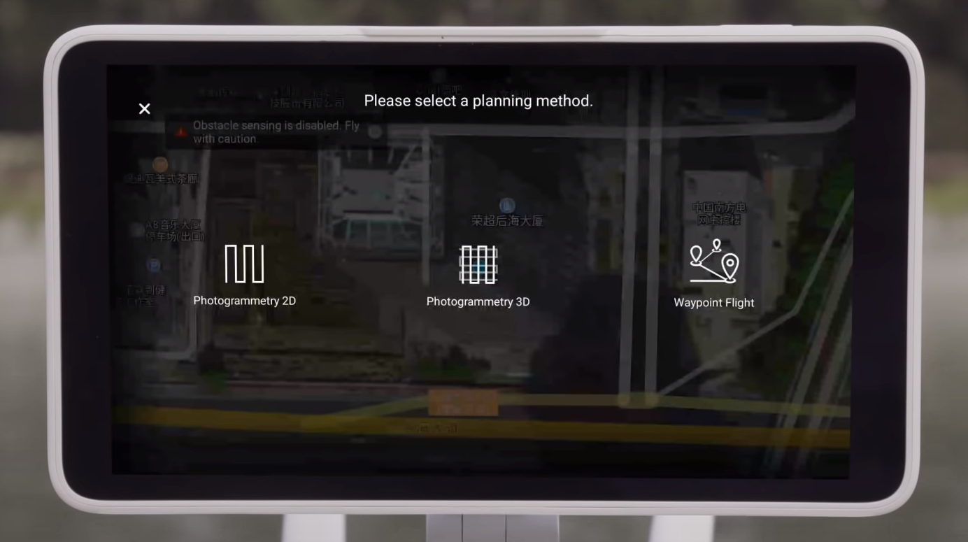
The new GS RTK app along with traditional flight modes will allow pilots to control the drone more intelligently thanks to two planning modes - Photogrammetry and Waypoint Flight. Planning modes allow the user to choose the flight path of the drone, while simultaneously adjusting the overlap ratio, altitude, speed, camera parameters, etc., providing an automated mapping process or control of the workflow at the output. Scheduled departures are easily repeatable, which makes it possible to collect the same data over different periods of time to track any changes in the controlled area.
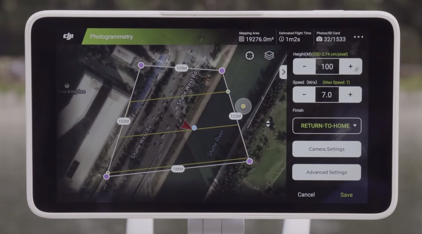
For planning a flight in the office, the GS RTK application directly downloads KML and KMZ files. The new Shutter Priority mode ensures stable exposure even when flying autonomously in high wind conditions.
D-RTK Mobile Station 2

Phantom 4 RTK is fully compatible with D-RTK Mobile Station 2, which is responsible for providing the drone with differential data in real time and forming an accurate geodetic solution. The robust design of the D-RTK 2,degree of protectionIP67,coupled with the OcuSync 2.0 video transmission system, ensures users receive centimeter-accurate data even in difficult conditions.
Phantom 4 RTK is easy to integrate into any workflow by connecting the positioning system to the D-RTK 2 mobile station via a 4G dongle or Wi-Fi point using the NTRIP protocol (differential streaming GPS over the Internet), or you can save all the received data for subsequent processing by the method of kinematics in post-processing (PPK - Post Processing Kinematic).
Mobile SDK Support
The Phantom 4 RTK is compatible with the DJI Mobile SDK, giving the user direct access to drone functions for automation and customization via a mobile device.
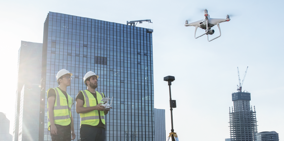
Phantom 4 RTK in practice
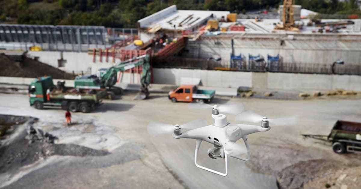
DJI works closely with European construction giant Strabag SE, a major player in transportation infrastructure. Using unmanned technologies in several mapping projects since 2010 to reduce costs and increase labor productivity, the company has managed to appreciate the benefits of using aerial photographs in 3D modeling. The latest tool for such tasks for the Strabag SE is the DJI Phantom 4 RTK.
“There are many advantages to using drones for mapping purposes. Their integration changed our workflow and simplified many of the operational steps, ”said Thomas Groeninger, Head of Digital Assessment of Assets and UAVs at Strabag SE. "Conventional survey methods also provide 3D models, but digital terrain models generated from drone data provide a high point density and therefore more detail."
Price
To order a drone, it is recommended to contact your nearest official DJI dealer, or send your contact information to the DJI team via the official website so that they can contact you.
- Phantom 4 RTK - 5700 €
- Mobile Station D-RTK 2 - 3600 €
- Phantom 4 RTK Mobile Station D-RTK 2 - 7800 €
FAQ
Drone
Q: What makes Phantom different 4 RTKs from previous Phantom models? A: All of the previous Phantom series have been geared towards professional photographers and drone hobbyists, the Phantom 4 RTK is designed for industrial users in areas such as precision mapping and inspection. The P4 RTK inherits a similar camera, shape and size, as well as the addition of an RTK positioning module, a new TimeSync system, a mapping application and much more.
Q: What propellers does the Phantom 4 RTK have? A: The P4 RTK is equipped with the standard 9450 props that come with the Phantom 4 Pro.
Q: Can I pilot the Phantom 4 RTK in other countries and regions? A: No, P4 RTK has specific versions for different countries and / or regions. Users can check the version code by finding it on the product packaging or through the GS RTK app (in the Drone Information section of the Firmware).
Camera
Q: What is the difference between the Phantom 4 RTK and Phantom 4 Pro / Advanced cameras? A: Although all three are built on the same 1-inch 20-megapixel CMOS sensor, the P4 RTK camera has been refined through a new lens distortion recording process. Each P4 RTK camera undergoes a calibration procedure, during which lens distortion is measured and the corresponding OPEN-CV parameters are recorded. The camera allows you to output the original images without correcting distortion, and the OPEN-CV distortion parameters recorded in the XMP file can be used in post-processing.
Q: Is it possible to use Phantom 4 Pro ND filters on the Phantom 4 RTK? A: Yes maybe ND filters made for P4Pro can also be used on P4 RTK.
Q: Does the aircraft's digital signal processor (DSP) support camera distortion correction? A: No, the user can enable in-camera distortion correction, but then the image fidelity will be less accurate compared to distortion correction in post-processing software.
Remote Controller
![]()
Q: What is the difference between the Phantom 4 RTK Remote Controller and the Phantom 4 Pro Remote Controller? A: The P4 RTK control panel has received a number of changes to meet the needs of industrial users, including: microSD slot, built-in speaker, hot-swappable batteries. In addition, users can connect control equipment to the Internet to operate Network RTK with a 4G key. Finally, a new specially designed GS RTK application is already preinstalled in every device, allowing the operator to start data collection tasks immediately after unpacking.
![]()
Q: Can the P4 RTK be controlled by the Phantom 4 Pro control gear? A: No.
Q: Is it possible to switch between FCC and CE modes? О: Switching between modes is not available.
Video Stream
Q: What is the FPV distance from the Phantom 4 RTK? A: The effective FPV offset distance depends on the user's operating methods (eg antenna position) and the actual environment in the manned area. In open and unclosed environment, the maximum FPV distance is 10 km (for FCC 5.8GHz) and 6 km (for CE 2.4GHz).
Q: Is it possible to continue the started mapping mission if during its execution the P4 RTK loses the video transmission signal? A: Yes, if the video transmission signal was lost, the user can restart the equipment and continue the mission.
Battery
Q: Is it possible to use P4 Pro batteries in the Phantom 4 RTK? A: Yes, drone batteries are completely interchangeable.
Q: How long does it take to fully charge the P4 RTK battery? A: It takes no more than 60 minutes to fully charge.
Q: How is it necessary to maintain and store the battery? A: Store in a dry place. Before long-term storage, make sure that the battery is charged at 50% or higher and discharges every three months to maintain performance.
Q: Is it possible to use the drone battery in low temperature environments? A: Battery performance drops dramatically in temperatures
Q: What applications have mapping and inspection functions? A: The pre-installed GS RTK application can be used for mapping and inspection. In addition, users can install applications created in the DJI Mobile SDK.
Q: Is the Return to Home (RTH) behavior of the Phantom 4 RTK different from the Phantom 4 Pro? A: No, the RTH P4 RTK mode is almost identical.
Q: Are there any restrictions on setting waypoints for P4 RTK? A: Yes, the distance between points cannot exceed 2 km, the total number of points cannot exceed 99, and the length of the flight plan must not exceed 15 km.
Q: Is it allowed to enter longitude and latitude values for setting waypoints? A: No.
Q: What is the maximum number of boundary points that GS RTK can support through imported KML files? A: Currently the application supports up to 99 boundary points.
Mapping
Q: What differential data formats does the Phantom 4 RTK support? A: P4 RTK currently supports: RTCM 3.0, RTCM 3.1, MSM4 and MSM5 in RTCM3.2 format.
Q: Are the coordinates measured by the Phantom 4 RTK absolute in the user-selected coordinate system? A: Yes, absolutely.
Q: How to calculate the required flight altitude based on the GSD value? A: To estimate the appropriate altitude, refer to the equation: H = 36 * GSD. It is worth paying attention to the fact that the size of the pixel on the ground (GSD) is measured in centimeters, and the "H" value (altitude or flight altitude) is measured in meters.
Q: Do the images captured by the P4 RTK save altitude data? If so, how is this data stored? A: Yes, they do. Altitude above sea level and relative altitude (relative to the user's take-off point). The absolute height can be used in mapping. The relative height is stored in the XMP file.
Q: How do I capture an oblique photograph with the Phantom 4 RTK? A: Slanted images can be acquired in photogrammetry mode in the GS RTK app. In the "Photogrammetry" mode, you can adjust the gimbal tilt angle from -90 ° to -45 ° in the camera settings for each flight plan. User can only set one gimbal angle value at a time. In order to get multiple angles, you need to plan the same mission and set the desired camera angle.
Q: Is it possible to create a 3D model or point cloud with third party software using images captured by P4 RTK? If so, what is the accuracy of the resulting model? A: Yes, it is possible. However, the accuracy will depend on the third-party software photogrammetry algorithm used. The software vendor should be consulted for the expected accuracy.
Q: What is the best way to use P4 RTK for corridor mapping? A: In cases where data is collected over an infrastructure or other narrow corridor, the developer recommends setting a high overlap factor, flying above normal and planning at least two flight paths for the same corridor.
Q: Is the Phantom 4 RTK compatible with third party base stations? A: No, it is not possible to connect third party base stations to the P4 RTK or radio control equipment. However, it is possible to receive data from a network RTK server via the Ntrip protocol in a 4G / Wi-Fi network environment. Satellite observation data can also be stored in the drone for post-processing (PPK).
Videos
Videos from DJI Phantom 4 RTK drones.
.